Thursday, 15 July 2010

Walking in North Wales Part 3


For our final challenge some of our group were offered a scramble up Tryfan. This is the only mountain in the United Kingdom apart from the Cuillin of Skye, to require scrambling on the ascent. At 3,002 feet (915m) above sea level it is one of the highest mountains in Wales. We began our ascent in the Ogwen Valley at the camp site. The mountain ahead of us looked a real but exciting challenge.


To reach the Heather Terrace we had to follow a track up the south-eastern flank of Tryfan which took us through this cleft in the rock.
Turning sharp left we reached the start of the Terrace – narrow outcrop of sedimentary rock sandwiched between two types of volcanic rock. Although it had some width to begin with it soon became much narrower.


Eventually the Terrace peters out and it became a bit of a scrabble up to the bwlch between the summit and the south peak where we had our lunch break.
A hands on scramble was needed to reach Adam and Eve at the summit.

The views from the top were truly excellent and underpinned a sense of achievement in reaching this point.

The descent to Cwm Idwal was a little easier after the first 50 metres.


Again the views were quite spectacular – Nant Francon .


Dropping down to Llyn Idwal.


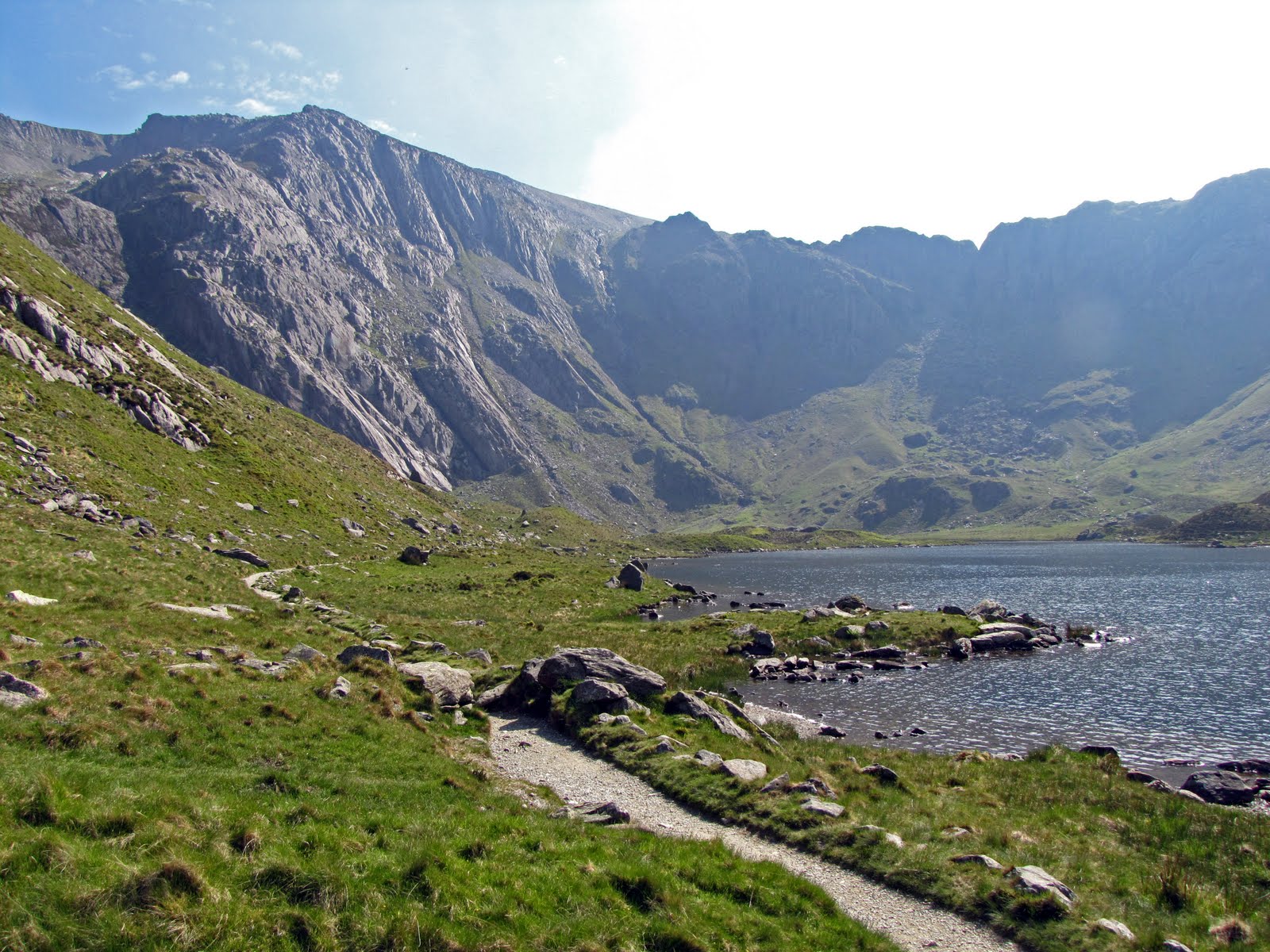
The Devil's Kitchen at Cwm Idwal with The Slabs on the left and deep cleft known as Twll Du to the right.


Finally, the group that I spent the week with.

Tuesday, 15 June 2010

Walking in North Wales Part 2


The Great Orme Tramway, a vintage tram system (built 1902), conveys visitors to the summit of the Great Orme a prominent limestone headland on the north coast of Wales north of Llandudno.


From the summit 207m (679 ft) there are excellent views back to the mainland as here beyond Deganwy and across the Afon Conwy to Conwy itself.

Also across Bae Conwy to the mountains of north west Wales.

The Great Orme Mines are possibly the most important copper mines of the Bronze Age yet discovered and excavated. Apparently abandoned around 600 BC, but with some evidence of Roman patronage, the mines were reopened in 1692 and continued to be worked until the end of the 19th century. Then buried in waste rock from local quarries, they were re-discovered in 1987 when the waste tips were in the process of being landscaped.

The narrow and cramped underground workings on 2 of the 16 levels can be explored.

On Thursday we began our walk in the village of Abergwyngregyn and climbed rapidly to pick up the trail through the Afon Anafon valley.

Abandoned stone walled sheep folds are quite common in this part of Wales especially on level terraces close to water.

At the head of the valley there was a steep climb to the top of Foel Fras 942m (3,091 ft). Although the approaches to these mountains are quite grassy the summits were always boulder strewn with sizeable frost shattered blocks of rock.

The top of Garnedd Uchaf 926m (3,038 ft) was similar.

The view south from the top of Garnedd Uchaf . I can’t remember the names of the main peaks.

During the descent we witnessed a helicopter rescue from the sheepfold on Gyrn.

Crossing the Afon Rhaeadr bach high above the valley floor, we took the opportunity cool ourselves with a hat full of cold water.

Aber Falls from the slopes of Moel Wnion.

Before descending to sea level once again we could glance back over the latter part of our route for today. 12 miles, 3325 ft of ascent and about 7 hours with stops.
Final posting covering the last day - to come. Watch this space.

Saturday, 12 June 2010

Walking in North Wales 30th May - 4th June 2010 PART 1

Our first walk started from Bryn Corach and proved to be an easy warm up, a taste for things to come. It was 8¾ miles and 1775 feet of ascent, lasting about 5 hours with stops. We travelled by field and lane and along hillside paths. From the top of Allt-wen 836 ft the whole of Conwy Bay was spread out below. The Great Orme is on the horizon to the left with Llandudno centre and the entrance to the River Conwy, right.
To reach Allt-wen we had to cross the top of the Sychnant Pass, once an old coaching road linking Conwy to the west before the coast road was built. Capelulo nestles at the foot of the pass while Tal y Fan keeps watch from the distance.
There are good views over Conwy from Conwy Mountain with its castle and three bridges over the river.
Conwy is an attractive but busy little town with a population of 14,200.
Moel Siabod sits isolated above the villages of Betws-y-Coed and Capel Curig. At 872m (2,861 ft) it is the highest peak in the Moelwynion mountain range. From the east looking, across the forested slopes of the Afon Conwy Valley, it looms majestically, in its isolation, over the Welsh countryside.
Our route took us from the Plas-y-Brenin National Mountaineering Centre in Capel Curig along the valley of the Afon Lugwy to the village and bridge of Pont Cyfyng. Our path rose gently uphill through birch wood, open moor and pine forest with good views of the mountain.

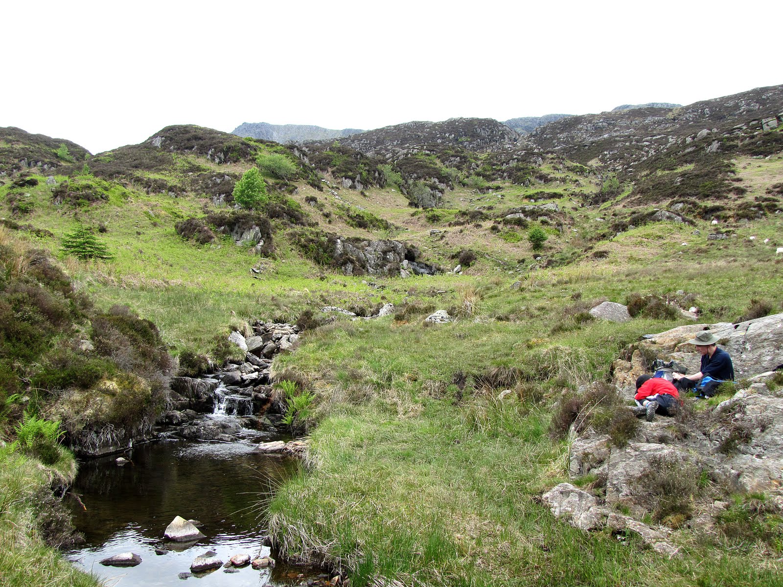
 We had our picnic close to a small stream within a sheltered cwm.

 
After following the wrong stream we back tracked to find Llyn y Foel. The main route from the lake rises gradually at first to the south but becomes steeper and rockier with some scrambling before turning sharply right to ascend the Daear Ddu Ridge to the summit.

From the summit the view of Snowdon and the Snowdon Horseshoe is magnificent.

The highest part of the mountain forms a relatively level, rocky ridge approximately 800 m long, running roughly south-west to north-east and the descent was rocky at first and then over steep grassy slopes before entering woodland and reaching Plas y Brenin again. 10 miles, 2525 ft of ascent, 6 hours.

View from Moel Siabod to the west.
View continued looking north.
My main reason for going to Conwy was to make my first ascent of Snowdon 1085m (3,560 ft). I was pleased to be able to do this although above about 400m the mountain was covered in a blanket of damp cloud which reduced visibility at the summit to only a few yards. We used the Snowdon Ranger Path which starts at the Youth Hostel on the edge of Llyn Cwellyn at the foot of Snowdon’s western flank. The path is the original ‘tourist’ route up the mountain and involves the greatest amount of ascent.

As we zig-zagged our way up the first few hundred metres we paused to watch a train of the The Welsh Highland Railway pass through the valley below pulled by one of the most powerful 2' gauge steam locomotives in the world.

Picnic was ‘enjoyed’ within the cloud along the top of the Clogwyn Du'r Arddu cliff face. Our best entertainment was watching Pete and four others of the group ‘demonstrate’ the emergency survival tent.

Near the summit we ‘heard’ the Snowdon Mountain Railway train pass by.

Reaching the summit for me was an exciting achievement but not everybody saw the day in the same light! We returned via the Rhyd Ddu Path. 7½m and 3075 ft of ascent, about 6 hrs including stops.

Wednesday, 6 January 2010

Away for Christmas


It seemed a good idea way back in the summer. An advert in The Times drew June's attention to a trip to Switzerland over Christmas. After a previous experience when a visit to Interlaken was washed out by floods, we had anticipated a return. A 'real' snowy Christmas in the Bernese Oberland was an attractive possibilty. And so it was arranged.
One advantage of the trip was that it was a no-fly option making use of trains to reach and return from Interlaken. Feeling secure as Christmas approached knowing that the proposed BA strike could not affect us we settled into our packing. Then the news broke that Eurotunnel had run into problems. What happened next will probably ensure that we do not go away again at Christmas. The outward journey was hastily rearranged with a coach from St. Pancras via Ebbsfleet to Dover, ferry to Calais and then over seven hours by coach to Dijon through snow covered countryside and then a fall of heavy snow which made driving difficult. After the exhausting first day things started to improve until we finally arrived in Interlaken.


This is the hotel we stayed in - Hotel Interlaken. Our room was on the third floor, in the centre, overlooking the street. Excellent double glazing ensured that we were never disturbed by noise outside. Good room, good hotel with history but restaurant closed on Sundays and Mondays in winter. But as you can see we seem to have left all the snow in France and England!
      
                           
Interlaken is an attractive town, especially the older part, Unterseen, and is set between two lakes, the Thuner-see and the Brienzer-see. It is an expensive town by English standards but probably no more so that most of Europe today. But no snow!

                       
Thuner-see was rough and univiting when we took our investigative seven and half mile stroll on Christmas morning.


Deep in the woods we found a ruined medieval castle. This is the view of the lake from the top of the keep.


After a beautiful but snowless walk involving a embarrassing moment with a toilet block, an attractive river walk and a footpath around the near vertical wall of HarderKum, we returned to Unterseen.


Arriving at Grindelwald 3,393 feet. Is that snow I see?


We were promised a sleigh ride! Does that mean we shall be out on snow?


Plenty of ice.


Then we found our first snowy scene in the centre of Grindelwald. Wetterhorn and Schreckhorn behind.


Our sleigh ride took us a viewpoint where we had a welcome glass of glühwein and watched the lights come on in Grindelwald below.


On Boxing Day we took the train from Interlaken via the Lauterbrunnen Valley, Wengen, Wengenalp, Kleine Scheidegg and through the EigerTunnel to Jungfraujoch - Top of Europe. It was a spectacular day and this is the view looking NW from the observation platform at the top, 3454m.


Looking SE over Jungfraufirn to the Aletsch Glacier.


The Jungfrau 4158m (13,642 ft).


The Monch 4107m.


June ventures into the ice palace.


Deep in the ice figures like these penguins had been carved forming discrete tableau.


From Jungfruajoch far below we could see Mannlichen which we had planned to visit on the morrow if the weather held. The little figures indicate our intended route to the summit view point from the cable car station.

Our ascent of Mannlichen began at the heavily commercialised mountain resort of Wengen.


We needed to take the cable car (ringed) to the Mannlichen Station, also ringed and then make our way along the ridge to the left.


Arriving at Mannlichen Station


Leaving time for the hordes of skiers to zip off, we prepared ourself for our walk to the Mannlichen view point. The snow was surprisingly easy to walk on and inspite of the fact that it was a bit of an uphill struggle, we made good time. When we reached the top the views were simply amazing.


Looking east we see Grindelwald nestling in its valley with Wetterhorn behind, Schreckhorn and the lower slopes of the Eiger on the right.


To the southwest is the deeply U-shape of the Lauterbrunnen Valley with Grimmelwald and Murren on their 'alps' above the valley floor, just right of centre. The mountains are from left to right - Grosshorn 3754m, Breithorn 3782m, Tschingelhorn 3557m and Gspaltenhorn 3437m.


Looking south we could see the north face of the Eiger overlooking our route from the Mannlichen Restaurant, middle right-hand side. Just seen is the observatory in the col to the right of the Monch where we were yesterday.

Back down at the restaurant we could get a closer look at the three famous peaks. From left to right - Eiger, Monch and Jungfrau. In the foreground is Tschuggen behind which lies the station at Kleine Scheidegg.


Our journey home was by train via Lucerne, Basel, Remagen, Cologne and Brussels. We stopped overnight at Remagen which gave us half a day to explore the town. Remagen is a town on the River Rhine in Germany. It is about a one hour drive south of Cologne. A ferry is the only way of crossing the river here.


Remagen has many beautiful and well-maintained buildings, churches, castles, and monuments. It also has a sizeable pedestrian zone with plenty of shops.


The Ludendorff Bridge (or Bridge at Remagen) was originally built during World War I as a means of moving troops and logistics west over the Rhine to reinforce the Western Front. The bridge carried two railway tracks and a pedestrian walkway. During World War II, one track was planked over to allow vehicular traffic. It was the last bridge standing on the Rhine when captured by soldiers of the U.S. 9th Armored Division on 7 March 1945. Although German engineers had mined the bridge before the American approach, the fuses had been cut by two Polish engineers and the bridge was captured intact. After subsequent German bombing and mining it finally collapsed 10 days later.


And then we went home!