Sunday, 28 November 2010

The American West Part 4: The Snake River and Grand Teton National Park

The Snake is the largest and longest tributary of the Columbia River, which flows into the Pacific Ocean. It starts out as a small river in the Yellowstone NP flowing west and south for some 50 miles into Jackson Lake and then through the valley of Jackson Hole, which cuts between the Teton Range and the Continental Divide. In these first 100 miles it meanders through mountain meadows, and forests of fir, spruce and aspen, with the Tetons as a spectacular backdrop.


Early in the morning, shortly after dawn we took a float trip down the river in the Jackson Hole country. Although we started off in silent, foggy conditions, the only sound being the 'plop' of the oars dipping into the water.....


the mist began to lift .......


and we started to appreciate the wonder of our surroundings in bright early morning sunlight. We floated downstream for about 13 miles or so spotting beaver dams and bald eagles.


With no foothills to obstruct your view, the jagged peaks and deep canyons of the Teton Range rise abruptly from the Jackson Hole valley.


Some 100 million years ago the collision of tectonic plates along North America's west coast bowed-up a vast block of the earth's crust. Eventually the dome was fractured along a line known as the Teton fault. Massive earthquakes caused the mountains to rise while the valley floor in the foreground, dropped. More recently huge glaciers flowed south from Yellowstone eroding the mountains and transporting and depositing vast volumes of rocky glacial debris. Towards the left shrouded in cloud is Grand Teton, 13,770 ft and in the centre is Teewinot Mountain, 12,325 ft.


Here at Jenny Lake facing us is the mountain valley of Cascade Canyon. It was once occupied by a glacier which flowed into the foreground leaving a semi-circular wall of moraine on which I'm standing. Behind this the meltwater lake was impounded. High to the right is Hanging Canyon and on the left, Teewinot Mountain.


Perhaps one of the most beautiful and photogenic spots in Grand Teton National Park is Oxbow Bend, a loop of the Snake River that was left behind, when the river cut a new path through the neck of a huge meander, just slightly to the south.


Above we are looking west, back towards the Tetons. Below we look east towards Uhi Hill 7,443 ft..

Sunday, 21 November 2010

The American West Part 3: Salt Lake City and Jackson Hole

Salt Lake City is the capital of Utah. The city was founded in 1847 by a group of Mormon pioneers led by their prophet, Brigham Young, who left behind hostility and violence further east. They extensively irrigated and cultivated the arid valley formerly occupied seasonally by the Northwestern Shoshone. The city lies at the foot of the Wasatch Front and is separated from the Great Salt Lake by extensive marshlands and mudflats. Salt Lake City is home to the headquarters of The Church of Jesus Christ of Latter-day Saints but less than half the population is Mormon today.


Looking south beyond the domed Utah State Capitol and along the broad State Street with Main Street to its right. The twin spires of the Temple can be seen tucked between the buildings, middle right.


Some of the main buildings associated with Temple Square from the roof gardens of the Conference Centre


The Handcart Pioneer Monument is a tribute to the early Morman pioneers that could not afford the larger ox-drawn wagons and so walked across the rugged plains in the 1850’s, pulling or pushing all their possessions on hand made wooden carts. Some 250 died on the journey but nearly 3,000, mainly British converts, completed the 1,350 mile trek from Iowa City.


Joseph Smith (1805-44) founder of the Latter Day Saint movement stands amidst the flower gardens of Temple Square.


The Conference Centre auditorium can seat 21,000 people without pillars or columns to interrupt the view.


Jackson is a major gateway for millions of tourists visiting nearby Grand Teton National Park and Yellowstone National Park. It is located in the Jackson Hole valley of Teton County, Wyoming.


Tourism and skiing form the basis of the local economy. The main shopping and eating district is centered around the town square. All types of goods can be found and local art is important embracing the strong western tradition.


The four corners of the square are accessible through arches built of discarded antlers, originally collected by local school children.

The American West Part 2: Zion and Bryce Canyons


Zion National Park is near Springdale, Utah. A prominent feature of the park is Zion Canyon, 15 miles long and up to half a mile deep, cut through the reddish and tan-coloured Navajo Sandstone by the North Fork of the Virgin River. There are four distinct natural zones, desert, river, mixed woodland and coniferous forest, which support a range of unusual plants and animals. These zones are spread among the park’s mountains, canyons, buttes, mesas, monoliths, rivers, slot canyons, and natural arches. Unfortunately it was a wet when we arrived, with low cloud and we were unable to appreciate Zion’s full glory.


Weeping Rock. The sandstone of the cliff is quite porous and the rain that fell on the plateau above slowly percolates down until it reaches the clay of the Kayenta Formation. Here it seeps out creating moist nooks filled with lush vegetation and flowers that cling to the precipitous cliffs.


The Riverside Trail follows the course of the Virgin River until it reaches a slit little more than 20 feet wide and a thousand feet deep. To travel further you need to walk in the river itself.

Some distance NE of Zion and reached by the twisting and narrow tunneled Zion-Mount Carmel Highway is Red Canyon, a shallow valley in the side of the Paunsaugunt Plateau surrounded by much exposed and sculpted orange red sandstone. The escarpment here is known as Sunset Cliffs.


About 10 miles further north is Bryce Canyon National Park. The major feature of the park which, despite its name, is not actually a canyon but a giant natural amphitheatre, has been created by erosion along the eastern side of the Paunsaugunt Plateau. Bryce is distinctive because of its hoodoos, formed by wind, water and frost weathering of ancient river and lake bed sedimentary rocks. The red, orange and white colors of the rocks provide spectacular views like those at Bryce Point.


We arrived here late in the day. The weather was disappointingly dull with drizzle in the air but the splendor of the Bryce Amphitheatre was easy to appreciate.


The narrow pinnacles of rock known as hoodoos march forward in rows. With imagination you can picture minarets, pagodas, skyscrapers, camels, rabbits, turtles and people. The next morning low cloud prevented further exploration of what the canyon had to offer and we were soon on our way further north.

Monday, 15 November 2010

The American West Part 1 Las Vegas


In October June and I took our much anticipated trip to the American West in order to visit Las Vegas, ten National Parks and some of the western sites made famous in the nineteenth century. We began and ended the trip in Las Vegas.


One of several storms to pass over Las Vegas during our stay.


New York-New York, one of many themed hotels. Built to a one-third scale of the real thing includung the Empire State Building and Statue of Liberty.


The Paris Las Vegas Hotel complete with one-half size Eiffel Tower.


The MGM Grand Hotel even has its own lions.


The Bellagio has its dazzlingly choreographed musical fountains.....


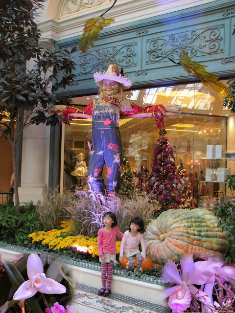
...and lavish conservatory.


Caesar's Palace has its Forum Shops with associated Roman attractions,


including a reinactment of the last days of Atlantis.


It is only at night that the city really comes alive and it's difficult not to become swept up in it all.


The Bellagio fountains are simply magical.


The Stratosphere Hotel Tower sits mid-way between the Strip to the south and Downtown to the north.


Freemont Street in Downtown is covered with a dome that exhibits a light display to music every half hour.


We rounded off our stay in Las Vegas with a visit to a show at the Excalibur Hotel.