Sunday 30 October 2011

Day 7 An animal day.

Day 7
THE KENAI PENINSULA
A stop off at the Alaska Wildlife Conservation Centre and a sightseeing trip into Aialik Bay from Seward.

We journied south east from Anchorage along the Seward Highway to the head of the fjord called Turnagain Arm. The early morning fog that hung over the water was just clearing and elements of the "Drowned Forest" with ghostly, bleached dead trees provided a reminder of the 1964 earthquake when the land dropped 4ft and the sea rushed in. Here at the entrance to the Kenai Peninsula lies the Alaska Wildlife Conservation Centre with its selection of rescued and bred animals like this grizzly bear having an early morning nap.

This is a non-profit making organisation dedicated to conservation and education. Where possible rescued animals are later released. The grizzly bear above was badly crippled by porcupine quills when found.
Below one of two Kodiak brown bear cubs that had been orphaned on Kodiak Island.


Each animal had its own story to tell but some were being bred in order to increase numbers in the wild like these musk ox.


We also saw caribou
and moose
among other animals and then it was time to journey further south on the highway to Seward. From Seward we took a sightseeing cruise by jet boat through Resurrection Bay and into Aialik Bay. Near the entrance to Resurrection Bay we passed Bear Glacier
and then as we cruised to the head of Aialik Bay we passed Pedersen Glacier the snout of which hides behind a chain of low lying morrainic debris forming rocky islands.

The Harding Icefield is 70 miles long and 30 miles wide and covers the Kenai Mountains to the north and west of the fjord. One of its most spectacular glaciers is Aialik Glacier
which lies at the head of the fjord
and regularly calves bocks of ice into the bay.

Returning past the Chiswell Islands, lonely rocky outcrops at the threshold to the bay, we spotted a rookery of Steller Sea Lions
 but so too had a group of passing killer whales.

Back in the sheltered waters of Resurrection Bay sea otters were taking time out to relax.

Soon it was time to end the land part of our trip and as we returned towards Seward we could see our cruise ship waiting for us at the quayside.


Sunday 23 October 2011

Day 6 Anchorage

Day 6
IN AND AROUND ANCHORAGE
We began the day with a visit to the most amazing 'airport' that I've ever seen. The shoreline and adjacent marina like 'births' of Lake Hood form the world's busiest float plane base, much of it pure 'Biggles'. Some sections of the base were just packed with 100s of float planes, like boats in a marina. The picture does not capture this feeling.
 While other members of the group visited the Ulu Factory (native Inuit cutting tool) we strolled down to the banks of Ship Creek which was the site of the original tent city from which the town grew. Unlike other Alaskan settlements, Anchorage's origins had not depended on local mineral resources or fishing. It was founded in 1914 as a railroad construction port for the construction of the Alaska Railroad. Today's town is on higher ground to the south of the original low lying site. 

The Alaska Native Heritage Center is an educational and cultural institution for all 11 of Alaska's major cultural groups. Within the Center is the Gathering Place a focus for Native dancing, competitive Native Games demonstartions and intriguing story telling.


Outside we strolled through 6 authentic life-sized Native dwellings situated in a wooded area around beautiful Lake Tiulana. Each village site exhibits aspects of Native culture and has related artifacts including a guide to explain and interpret what is to be seen.
Above is an Eyak house and below detail from a column inside the house. Eyak occupied that lands alongside the Gulf of Alaska from the Copper River Delta to Icy Bay. Until the C18th the Eyak were more closely linked to their Athabascan neighbour to the north than the Nortrh Coast Cultures to the south.
The Athabascan (Dena) people are the most numerous and traditionally lived along the rivers Yukon, Tanana, Susitna, Kuskokwim and the Copper. It was an Athabascan village that we visited when in Fairbanks.
 Their totem poles are an intriguing feature that preserve the history and ancestry of the people living in a particular village. They are read from the top down.

The territory of the Aleut and Alutiiq stretches from Prince William Sound to the end of the Aleutian Islands in the west. Their culture is strongly influenced by the Russians and includes Russian dishes, the Orthodox Church and some Russian words in their language. These strangely 'hobbit' like dwellings were easily protected and an insurance agaist the worst winter weather. Each had a narrow 'escape' passage at the rear.

For lunch we returned to the centre of Anchorage and afterwards wandered around a surprisingly modern shopping centre with its own central park and sophisticated malls. What a contrast!

Sunday 16 October 2011

Day 5 On the Rails

Day 5
THE ALASKA RAILROAD
In 1912 the US Government surveyed a route for the railway from Anchorage to Fairbanks. The building of the route was completed in 1923 when the 700ft Mears Memorial Bridge was built across the Tanana River at Nenana (see earlier Nenana photo). We boarded the Denali Star at about midday at Denali NP Station. The diesel-electric locomotive engine shown here which pulled the train is known as a 70 MAC.

As we left Denali we could see our hotel on its bluff across the river.

The journey was 348 miles and took 8 hrs. Top speed was 59mph but most of the time we seldom exceeded 30mph because the track winds through mountains and valleys. After 44 miles we reached Broad Pass which is the watershed of the Alaska Range and at 2,300ft is its lowest pass.
The scant trees and obvious tundra were a pointer to what conditions must be like up here during winter. After another 20 miles we crossed Hurricane Gulch by the longest bridge on the railway at 914ft and some 296ft above the river. It was built in 1921 by the American Bridge Company.
The end of the train can be seen here crossing the bridge.
In another 20 miles we crossed another river. This time it was the Susitna River and the bridge built in 1921 spans 504ft.


The journey followed on much the same and eventually we reached Anchorage.

Day 4 Denali National Park

Day 4
INTO THE ALASKAN WILDERNESS
The Denali National Park covers a huge area, some 9,420 sq. miles. It is a fascinating glimpse into a sub-arctic landscape found throughout this latitude around the world but only really accessible to 'ordinary' people here. Just one road ventures into the wilderness and is only accessible by the official shuttle bus service.  
The only other way to see the park is from the air.
Courtesy of this Eurocopter AS 350 B2 built in 1999 I was able to fly amongst the peaks of the Alaska Range.
From the heliport on the east bank of the Nenana River we were soon passing over the lower heights of the Range.
The lower non-snow covered peaks exhibited a range of coloured rocks like this part of Polychrome Mountain.
As the peaks became higher so the snow cover increased.

Typical glacial features were in abundance not the least of which were the glaciers.


We flew between frost shattered peaks the names of which I can't remember.
Until we came within reach of Mt. McKinley reaching up 19,470 ft into the clouds.
With only the lower north slope visible we turned to make for home.
The return journey was to the south of our outward trip.
Coming into the heliport at bottom of photo and with our hotel on the bluff, top left.
In the afternoon we took an 8hr 'safari' style trip into the Park on one of the Park Shuttle buses. The long trip took us late into the evening and during the early stages we saw very few animals but after about 30 miles we reached the Teklanika River where the taiga (boreal forest of conifers) began to give way to the open tundra.
After some 40 miles we edged slowly round the bends of Polychrome Pass....
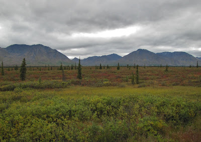
.......to reach Polychrome Overlook with its multicoloured landscape rising out of the open tundra, a fascinating world of dwarfed shrubs and miniaturised wildflowers.
Looking south from the Overlook the Alaska Range stretched before us from east to west.
It seemed a good place to have our picture taken.....
........ with Mount Pendleton 7,840ft behind.


We did eventually start to see the wildlife that we were promised but usually only at great distance from the road, like Dall Sheep,
berry picking grizzly bears,

and perhaps rarest of all, an alpha male wolf and his mate starting to cross the Toklat River East Fork. 
Both these wolves had collars on and are largely responsible for one of the Park's more famous wolf packs. Apparently they are seldom seen by visitors. Probably the highlight of the trip was to be able to see Mt. McKinley clearly.
Like the wolves, this is a rare treat being visible like this for only 2 or 3 days a month. 
Seen here from Stony Hill, it made up for the mornings disappointment. 
The mountain is some 45 miles away.
Lingering at the viewpoint until the last possible moment we then had to begin our 60 mile bus ride back along the narrow twisting road through the park. Even as we travelled the pale shades of evening sunlight lit up the surrounding mountains with a pink glow.