
Our first walk started from Bryn Corach and proved to be an easy warm up, a taste for things to come. It was 8¾ miles and 1775 feet of ascent, lasting about 5 hours with stops. We travelled by field and lane and along hillside paths. From the top of Allt-wen 836 ft the whole of Conwy Bay was spread out below. The Great Orme is on the horizon to the left with Llandudno centre and the entrance to the River Conwy, right.

To reach Allt-wen we had to cross the top of the Sychnant Pass, once an old coaching road linking Conwy to the west before the coast road was built. Capelulo nestles at the foot of the pass while Tal y Fan keeps watch from the distance.

There are good views over Conwy from Conwy Mountain with its castle and three bridges over the river.

Conwy is an attractive but busy little town with a population of 14,200.

Moel Siabod sits isolated above the villages of Betws-y-Coed and Capel Curig. At 872m (2,861 ft) it is the highest peak in the Moelwynion mountain range. From the east looking, across the forested slopes of the Afon Conwy Valley, it looms majestically, in its isolation, over the Welsh countryside.

Our route took us from the Plas-y-Brenin National Mountaineering Centre in Capel Curig along the valley of the Afon Lugwy to the village and bridge of Pont Cyfyng. Our path rose gently uphill through birch wood, open moor and pine forest with good views of the mountain.
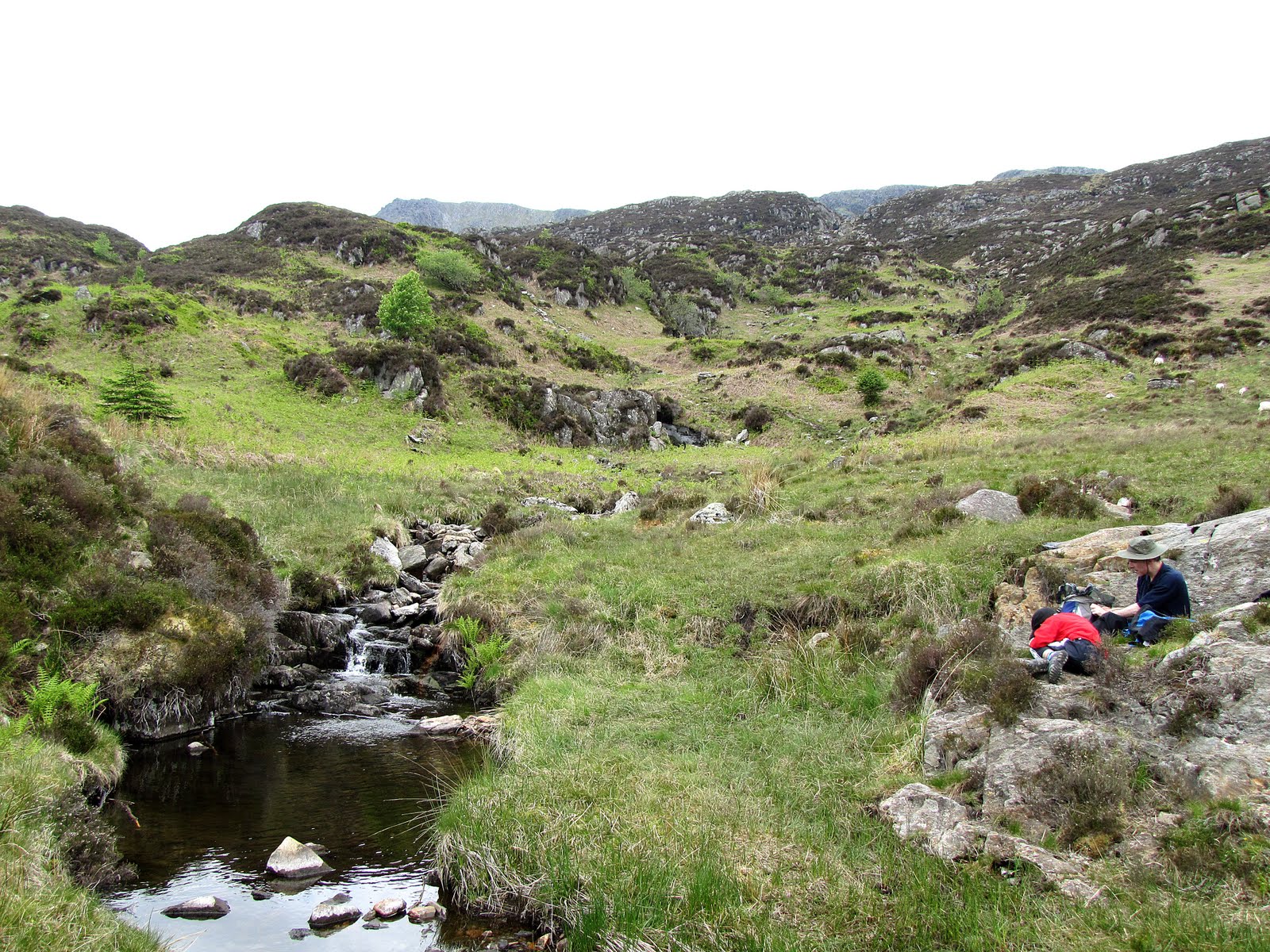
We had our picnic close to a small stream within a sheltered cwm.

After following the wrong stream we back tracked to find Llyn y Foel. The main route from the lake rises gradually at first to the south but becomes steeper and rockier with some scrambling before turning sharply right to ascend the Daear Ddu Ridge to the summit.

From the summit the view of Snowdon and the Snowdon Horseshoe is magnificent.

The highest part of the mountain forms a relatively level, rocky ridge approximately 800 m long, running roughly south-west to north-east and the descent was rocky at first and then over steep grassy slopes before entering woodland and reaching Plas y Brenin again. 10 miles, 2525 ft of ascent, 6 hours.


My main reason for going to Conwy was to make my first ascent of Snowdon 1085m (3,560 ft). I was pleased to be able to do this although above about 400m the mountain was covered in a blanket of damp cloud which reduced visibility at the summit to only a few yards. We used the Snowdon Ranger Path which starts at the Youth Hostel on the edge of Llyn Cwellyn at the foot of Snowdon’s western flank. The path is the original ‘tourist’ route up the mountain and involves the greatest amount of ascent.

As we zig-zagged our way up the first few hundred metres we paused to watch a train of the The Welsh Highland Railway pass through the valley below pulled by one of the most powerful 2' gauge steam locomotives in the world.

Picnic was ‘enjoyed’ within the cloud along the top of the Clogwyn Du'r Arddu cliff face. Our best entertainment was watching Pete and four others of the group ‘demonstrate’ the emergency survival tent.

Near the summit we ‘heard’ the Snowdon Mountain Railway train pass by.

Reaching the summit for me was an exciting achievement but not everybody saw the day in the same light! We returned via the Rhyd Ddu Path. 7½m and 3075 ft of ascent, about 6 hrs including stops.

No comments:
Post a Comment